
Follow a Faribault Street Record Trail
A Faribault street directory search is most reliable when it follows the address through records that are keyed to land. Begin with the county map and parcel entry, not a conclusion about the people connected with that place. The address can lead to a county PIN, lot and block, plat, and current property context. Recorded documents can then confirm conveyances or liens. A historical directory or newspaper can test a past address, but it must be read in its own year.
- Enter the house number and street in the Rice County property search or map workflow. Save the address spelling, PIN, and map date.
- Open the map view and review the parcel boundary, plat, lot/block, street components, and the adjacent-parcel context.
- Use the Recorder to determine whether the parcel follows an Abstract or Torrens title path. Record document numbers and recording dates before ordering an image.
- For a current registration-status issue, use the individual MNVotes route with the required inputs or contact Rice County Elections. It is not a street-wide public roster.
- For an earlier occupant question, match the address to the closest available Polk volume, phone book, map, newspaper, or census record.
Ownership, tax-mailing, and address fields serve different purposes. None alone proves who is at an address today. A good record trail preserves both the source date and the identifier that ties the result to the parcel.
Faribault Street Directory Parcel Map
Rice County Beacon is the county's property-search and mapping route. County instructions describe an address or parcel search, a selected result, and the map tab. They also identify aerial imagery, two-foot contours, oblique views, soils, zoning layers, comparable search, print tools, and survey-corner links. These map layers help distinguish the physical place from a text-only address search. The live Beacon field labels were not retrievable during the research review, so do not assume a particular result-card layout.
The Rice County map instructions show the county's address-to-parcel workflow and available map controls.
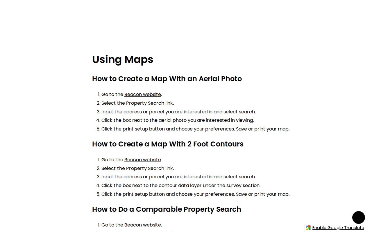
Use the map view to verify the selected parcel before moving to a recorded document. Aerials, contours, and oblique images are orientation tools, not substitutes for a legal description or deed image.
Faribault Street Directory Search Fields
The county's public ArcGIS parcel service gives a verified field inventory behind address work. It contains owner, PIN, street-component, ZIP, plat, lot/block, subdivision, property-type, recorded-date, city or township, post-community, and mailing fields. Field names in the service may not match Beacon's display labels. That distinction matters when repeating a query or requesting an official record.
The Rice ArcGIS parcel layer exposes the following address-related fields. A situs address is the physical location of a parcel, while a tax mailing address is where a tax notice is sent.
| Service field group | Field use | Search caution |
|---|---|---|
| COUNTY_PIN / STATE_PIN | County and state parcel identifiers | Keep with the query date. |
| ANUMBER and street components | House number, direction, street naming | Compare spelling and directional suffixes. |
| OWNER_NAME and owner-more | Recorded owner-field lead | Do not treat as present occupancy. |
| ZIP, ZIP4, city/township, post community | Address and geography context | These do not define municipal or postal limits. |
| Plat, lot, block, subdivision, recorded date | Land-description bridge to Recorder files | Confirm against the instrument image. |
The official service screen captured for this Faribault street directory reference shows the parcel-field source.
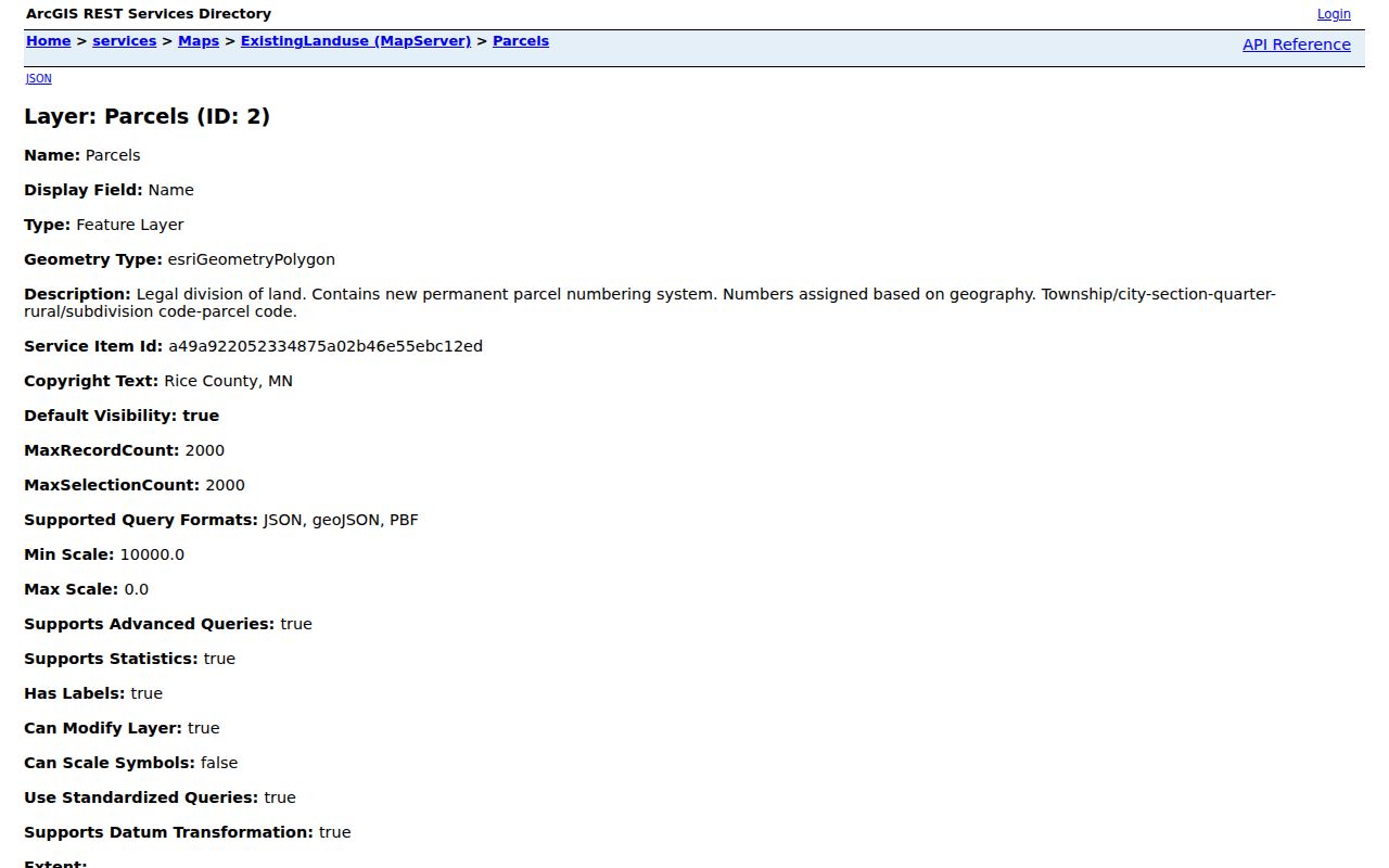
Its schema is useful for identifying which field belongs in a search note, particularly the PIN, plat, lot/block, street parts, and post-community context.
Faribault Street Directory Deed Path
The Rice County Recorder is where a street search becomes a title-record inquiry. The office records deeds, mortgages, releases, plats, liens, certificates of title, and other instruments. The practical order is to identify the parcel, determine whether land is Abstract or Torrens, search the grantor/grantee or tract route, note the document number and recording date, inspect or order the public image, and then follow linked instruments backward or forward. A grantor conveys an interest; a grantee receives one.
LandShark is Rice County's remote recorded-document and tract-image route. It is subscription access, and the live search fields and pricing were not verified in the research review. The Recorder's public research area and staff help are the fallback when remote access does not answer the question. The county's tract-image request route is designed for high-volume results and requires at least 25 results for consideration.
The captured LandShark entry screen establishes the official remote route without claiming a live search control that was not published in the researched materials.
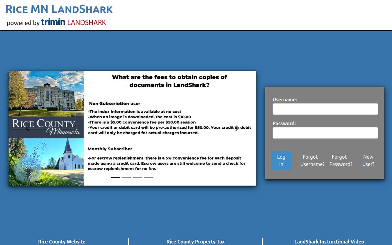
A recorded index entry establishes that an instrument was filed. Inspect the image or ask the Recorder for the public copy before interpreting its legal effect.
Faribault Street Maps and Quadrants
Faribault's city map system provides a second address check. The official maps route includes city overview, addresses, streets, voting precincts, city limits, and ZIP-area maps. The street map's directional conventions can resolve whether a record says NW, NE, SE, or another suffix. A county parcel field, city street map, postal city, precinct, and township can describe overlapping but different geographies.
Use the City of Faribault maps before deciding that an old directional suffix is a typo. If the place sits near the city edge, check whether the record concerns Faribault city, a Faribault mailing address, or an adjoining Rice County township. The street name plus PIN is a stronger anchor than the street name alone. The city planning material also describes four older neighborhood areas, but they are approximate historic geographies, not a current legal association roster or a street-level resident list.
Note: Historic records may use an abbreviated street, a former name, or an earlier numbering convention, so retain the spelling shown in each dated source.
Faribault Street Records by Address
Address-keyed sources work together, but each tells only part of the story. The Assessor and GIS establish the parcel context. The Recorder supplies the documented land trail. City permits and development materials can describe a public city action at an address. Historical maps and directories place a past address in a dated setting. Voter registration has tighter access rules and an individual lookup route, so it should not be treated as a list of everyone on a street.
| Address record | Custodian | What it can show | How to reach it |
|---|---|---|---|
| Parcel map and property fields | Rice County Assessor | PIN, address parts, plat, lot/block, map, owner or tax fields | Beacon and ArcGIS service |
| Recorded land documents | Rice County Recorder | Recorded parties, dates, instruments, title route | Research area, staff, or LandShark |
| City permits and development files | City of Faribault | Defined application, inspection, plan, certificate, or city action | City route or focused request |
| Street and address maps | City of Faribault | Quadrants, street context, city limits, precinct reference | Official map collection |
| Historic directories and maps | Buckham and RCHS | Dated address, block, or household research lead | Library, repository, or staff request |
A parcel is a defined piece of land in the county system. A plat is a recorded map that divides land into lots, blocks, and streets. A criss-cross directory is an address-arranged directory, but the RCHS collection description did not verify a particular Faribault criss-cross volume. Ask the repository for the exact year and format.
Faribault Street Directory City Files
City files can fill a narrow gap after the parcel and Recorder routes are checked. Faribault says its permit and application software changed in 2025. A defined request can identify a permit type, address, parcel number, application number, date interval, and the needed component such as an application, inspection history, plan set, final certificate, or correspondence. The city may redact or withhold part of a file under applicable classifications.
Use the city's written Minnesota Government Data Practices request route when the needed public city record is not published. The legal baseline is Minn. Stat. section 13.03. It allows inspection and copies of public data but does not require the city to create a new address list or provide a format it does not maintain. If a development action produced a resolution, ordinance, or plat, the city notes that approved material may also be recorded with the County Recorder.
Faribault Street Directories Before Today
Current parcel data should not be used to rewrite the past. For a prior address, use the nearest dated directory, plat book, Sanborn map, and newspaper issue. The Rice County Historical Society lists Polk directory runs from 1880 through 1993 with gaps, as well as phone books, plat books, photographs, obituaries, and Sanborn maps. Its staff-assisted Research Library is the correct route for a targeted year, street, person, or subject request.
The city directory collections are covered in more depth in the Faribault city directory records. Here, the key address lesson is to compare a map year with a directory year. RCHS holds Faribault Sanborn dates from 1884, 1893, 1899, 1905, 1909, 1921, and 1930. The Library of Congress also provides the May 1893 Faribault set with 11 sheets. A map can locate a building or street context, but it does not name every occupant.
Buckham Memorial Library's Faribault newspaper microfilm begins in 1856. Search a surname with a street, business, school, church, or event, and preserve the title, issue date, page, and whether the item came from film or a clipping.
Faribault Street Directory ZIP Check
The official City of Faribault ZIP Code Area Map from 2009 identifies 55021 for Faribault. It is a historical city reference, not a current delivery guarantee. The county parcel layer has ZIP and ZIP4 attributes, while the U.S. Postal Service provides the current address-to-ZIP route. A ZIP delivery area, city boundary, precinct, post community, and township are not interchangeable.
If an address fails a postal check, compare the city address map, the exact street spelling, and the county parcel PIN. Use ZIP only as a first route in the MNVotes lookup, then confirm county, city or township, house number, and street. For a deed search, the legal description and PIN carry more weight than the ZIP. Do not attach an old directory address to a current parcel without a dated map cross-check.
Limits of a Faribault Street Directory
A street-by-street public-record search has clear limits. A parcel owner field, tax address, old directory entry, or recorded document is not a present occupancy finding. Some information is private, confidential, redacted, or available only through a particular requester route. Safe at Home and voter-information withholding protect addresses and related information in specific situations. A missing online result can also mean that the record is held at a counter, in a subscription system, in a physical series, or under a different jurisdiction.
For a privacy or safety need, use the official Minnesota Safe at Home and voter-withholding channels. Do not attempt to reconstruct a protected location from map layers, old public records, or other fragments.
Faribault Tract Books in Numbers
Rice County's historic tract-book digitization is a useful bridge between a legal description and older land research. The county report describes more than 16,000 historic tract-book images spanning 1854 through the 1990s. Before digitization, older tract books were physical and the digital index was approximately 1987 forward. The collection adds a substantial research route for a Faribault street directory question when a modern address is not the best key.
Start with a parcel's legal description, then ask the Recorder whether the land is Abstract or Torrens and which tract or index route fits the date. The image total is a collection description, not an assurance that every item is remotely searchable. Keep the document number, legal description, date, and query route in the research note.
Note: A high-volume LandShark tract-image request is processed as time allows and is not a replacement for a complete title examination.
Faribault Street Research Gaps
The remaining gaps are specific. The live Beacon result layout and LandShark search controls were not available in the reviewed materials. No line-level Faribault directory scan was captured, and the city permit interface changed after its 2025 software launch. Use the official URL, public terminal, Recorder staff, city request route, Buckham, or RCHS to resolve the appropriate gap. Do not fill a missing field or result with an assumption.
For every Faribault street directory search, retain the exact address spelling, city or township, parcel PIN, legal description, source URL or collection name, date, and result type. That simple record lets the next searcher test a mapping or title connection without confusing a current parcel record with an older address reference.